See exactly where downtime risk is costing you — and how to fix it without adding staff.
Stop Wasting Time & Money on IT Headaches
You didn’t start your business to chase firewall errors, cloud sync failures, or “Where’s that file?” moments.
Yet here you are — juggling security patches, overloaded inboxes, and servers that randomly crash…again.
IT overload in small businesses isn’t just frustrating — it’s costly.
For a 50-employee company, even one hour of downtime can cost $25K+ in lost productivity and revenue. In industries like healthcare, the risks are even higher — a single HIPAA breach averages $429 per patient record, according to the IBM Security Cost of a Data Breach Report, 2023.
The challenge? Most small and mid-sized businesses (SMBs) can’t justify hiring more IT staff — but they also can’t afford costly downtime. Layer One Networks has supported South Texas businesses for 20+ years with IT that “just works“.
The Real Costs of IT Overload in Small Businesses
Lost Time = Lost Growth. Every IT fire steals hours you should be spending on clients and growth.
When your network goes down, clients go silent.
Rising tickets drain time and morale.
Compliance failures (HIPAA, PCI, FINRA) put you at risk.
Old systems and patchwork providers create more problems than they solve.
Without proactive support, many small businesses are left reacting to IT problems instead of preventing them.
How to Fix IT Overload Without Adding Staff
At Layer One Networks, we help small and mid-sized businesses across South Texas stay secure, productive, and compliant — without inflating payroll.
Local expertise — responsive, face-to-face support, not a call center
Proactive solutions — prevent downtime instead of scrambling after the fact
Peace of Mind — that your IT “just works”.
What We’ll Review in Your Free IT Check-Up:
You don’t have to choose between cost control and peace of mind. With Layer One Networks as your IT partner, you can reduce risks, protect your data, and give your team room to grow.
Firewall Strength & Data Security Gaps — find weak spots before attackers do
Backup & Disaster Recovery Readiness — ensure you can bounce back fast
Cloud Performance and Storage Efficiency — keep your team working anywhere
Help Desk Responsiveness & Server Stability — less downtime, faster fixes
Infrastructure Scalability for Growth — IT that grows when you do
Hi! I’m Jeremy
My career has been spent helping South Texas businesses cut downtime and stress. Let’s see where we can take the IT load off your shoulders in just 30 minutes.
If your crew’s waiting on a file to download or losing time to glitchy tech, it’s costing you more than just frustration — it’s money out the door.
In construction, delays don’t just inconvenience people — they blow up budgets. And yet, the tools your team depends on every day — Wi-Fi in the trailer, cloud-based plans, mobile devices, tablets, files, software — can fail at the worst possible moment.
That’s why Layer One Networks is here. We’re not just IT people. We’re your behind-the-scenes problem-solvers — making sure tech never stands in the way of progress.
🔨 What IT Looks Like in the Real World of Construction
Let’s be honest — tech is rarely the first thing on your mind. You’re dealing with crews, inspections, materials, timelines, weather, subs, and safety.
But when your systems break down?
You lose access to critical project plans.
Your team wastes time troubleshooting instead of building.
You risk blowing deadlines and losing trust with clients.
You leave sensitive data open to cyberattacks or theft.
Most construction companies we talk to aren’t trying to replace their entire IT setup — they just need someone to keep things running, fill the gaps, and jump in fast when things go sideways.
Sound familiar?
🧱 Common IT Headaches on the Jobsite
Let’s talk about the real-world pain points we solve every day:
🔧 What You Really Need from IT — And What We Deliver
At Layer One, we’ve supported Texas construction teams for over 20 years. We understand that IT needs to be:
✔️ Fast and invisible ✔️ Secure and field-tested ✔️ Built to scale as you grow
We work with your systems, your tools, and your timelines. No big learning curves. No bloated packages. Just hands-on, real-world IT — designed for contractors, not coders.
Whether you’re rolling out a new project, hiring new field techs, or just tired of fighting with printers and lost passwords — we’ve got your back.
🛠️ Real Support for Real Builders
You don’t get paid to troubleshoot tech.
You get paid to finish the job — on time, on spec, and without excuses.
Layer One Networks helps general contractors, developers, and subs stay connected, secure, and supported — from the back office to the jobsite.
We don’t just fix problems. We prevent them before they start.
Let’s Talk — Free 30-Minute Construction IT Health Check
If your tech isn’t helping you move faster, safer, or smarter — it’s time to make a change.
We’ll help you spot the cracks before they turn into chaos. No obligation. No pressure. Just 30 minutes of clear, practical insight into how to make your IT stronger.
In the digital space, with ever-evolving technology, businesses rely on the latest technologies and digital tools to build robust IT infrastructure, high-performance systems, and networks. Networks are the backbone of a successful business, and network monitoring is crucial in maintaining IT infrastructure.
As organizations rely entirely on digital infrastructure to manage different operations, communicate with customers, and drive innovation, maintaining a robust and secure network is essential for smoother business operations. Businesses can focus and concentrate more on monitoring different types of networks.
In essence, network monitoring is an essential practice of continuously observing the network devices or computer networks for slow loading or failure of network components to ensure a network’s optimal performance, security, and reliability.
For this purpose, dedicatednetwork design services are available to help organizations better design their networks. In this blog, we will discuss crucial reasons behind network monitoring is crucial for businesses of all sizes.
Reasons For Using Network Monitoring For Businesses
There are crucial reasons and parameters to decide the importance of network monitoring for businesses of all sizes.
Proactive Approach For Issue Resolution and Detection
One of the major benefits of network monitoring is the ability to detect network issues in advance before they become major problems. With a secure and robust network monitoring system, it becomes much easier for businesses to detect anomalies, vulnerabilities, and irregularities in real time.
This unique proactive approach with dedicated IT support means that potential disruptions that occur directly in hardware and software failures, bandwidth bottlenecks, or security breaches can be addressed instantly, which minimizes system downtime and ensures smooth operations.
Improve Network Performance
Network performance is an important parameter or metric directly impacting a business’s productivity and efficiency. Network devices with slow speeds, high system disruption, and poor connectivity can frustrate employees and disrupt critical business processes.
In this regard, network monitoring helps maintain optimal network performance by continuously tracking the key performance metrics, such as packet loss, latency, and network throughput.
By analyzing these primary metrics, businesses can quickly identify the problems in performance bottlenecks and make informed decisions to improve their network infrastructure. In this manner, managed cloud hosting services help companies host their network infrastructure services for smooth and reliable network operations.
Cost Efficiency
Investing more in network monitoring software will be better, which can lead to reliable cost savings in the long run. By preventing network downtime and minimizing the impact of security breaches through network monitoring tools and managed IT services, businesses can avoid the substantial costs associated with data breaches, lost productivity, and frequent system repairs.
Moreover, network monitoring enables better resource allocation after identifying the underutilized network assets and optimizing network usage, ensuring that businesses can get the most out of their existing businesses.
Security And Threat Management
Cyber threats are uncontrolled in this digital era, and ensuring the security of business networks is essential. In this regard, network monitoring and the simple network monitoring protocol (SNMP) are crucial in managing cybersecurity by providing consistent IT support, continuous network traffic surveillance, and detecting highly suspicious activities.
Also, advanced network monitoring tools can instantly identify potential security threats in real time, such as unidentified networks, unauthorized network access, malware, and phishing attempts. By instantly addressing these threats and issues, businesses can severely protect their entire reputations from the damage caused by cyberattacks.
Compliance And Reporting Functions
Many industries continuously rely on online platforms, and network performance directly impacts the customer experience. Slow loading times, connectivity issues, and service interruptions can lead to revenue loss and unsatisfied customers.
For this reason, the combination of network monitoring and managed cloud hosting services ensures that businesses remain compliant with these regulations by providing detailed logs and reports of network activities. It also helps in meeting compliance needs and requirements by providing valuable insights during security audits and investigations. In this manner, you can know about theimportance of network management for your business.
Reducing Network System Downtime
It is essential to know that system downtime harms and damages any business. It directly leads to lost business productivity, revenue, and customer trust. For instance, network monitoring and managed IT services notably reduce the risk of network downtime by providing real-time alerts and notifications about potential network issues. This unique process enables IT teams to respond effectively adn quickly, minimizing the impact of network outages and ensuring continuous business operations.
Improving IT Team Efficiency
A well-implemented network monitoring system continuously streamlines IT teams’ tasks by highly automating the detection and resolution of network issues. This unique process allows IT professionals to concentrate and focus more on strategic initiatives and complex problem-solving rather than spending more time on regular and routine network maintenance.
As a result, IT teams’ efficiency and productivity improve at a faster rate, contributing more to the overall success of the business. In this manner, IT team efficiency increases substantially by optimizing network design to achieve higher success.
Data-Driven Decision Making
Businesses generate large amounts of data, which is a vital and valuable asset for any business and can drive informed decision-making capabilities. Network monitoring software and tools generate a unique wealth of security, network performance, and usage data.
By strictly monitoring and analyzing this data, businesses can gain highly accessible insights into their network infrastructure, identify trends, and make strategic decisions that align with their core business objectives. This highly unique data-driven approach helps optimize network performance and align it with business goals.
Competitive Advantage
In today’s competitive business environment, having a reliable and efficient network infrastructure is crucial and provides a competitive advantage. Various businesses invest more in network monitoring software and tools better equipped to deliver seamless services, protect sensitive data, and adapt to changing market conditions. It positions businesses higher and ahead of competitors who may need help with continuous network-related issues and disruptions.
Get Professional Advice Regarding The Importance Of Network Monitoring
Network monitoring is a technical necessity and a strategic consequence for businesses in today’s digital era. It directly ensures the network infrastructure’s security, reliability, and performance, impacting business operations and success.
By continuously investing in comprehensive network monitoring solutions and software, businesses can proactively manage potential issues, strengthen security, optimize performance, and make data-driven decisions that drive innovation and future growth.
Connecting with amanaged IT services provider can further streamline this process. They offer expert support and advanced tools to maximize the benefits of network monitoring. In an increasingly interconnected world, network monitoring is the unique way to maintain a competitive edge and ensure long-term success.
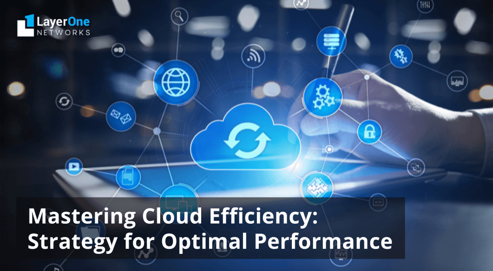
Businesses continuously rely on cloud computing technology to streamline operations, improve scalability, and increase productivity with the latest technological advancements. The cloud provides unmatched flexibility, versatility, and ease of access, enabling businesses to adjust to the changing needs of companies instantly. However, improving effectiveness becomes increasingly essential as reliance on cloud services grows.
With cloud usage increasing, streamlining business operations for maximum efficiency becomes essential. It requires carefully managing resources and optimizing workflows to ensure smooth functioning. Organizations continuously evaluate their cloud strategies, identifying areas of improvement and practically implementing solutions to improve performance.
By prioritizing efficiency, businesses can completely capitalize on the benefits of the cloud, allowing companies to stay ahead in the competitive environment in a rapidly evolving business landscape. This blog discusses cloud efficiency and strategies to maximize performance and minimize costs. Using managed cloud services in your IT infrastructure allows you to evaluate the cloud computing needs according to your business needs.
What Do You Mean By Cloud Efficiency?
Cloud efficiency simply refers to the different ways in which an organization can utilize its cloud services and resources in various data centers, avoiding unnecessary waste. It involves using resources effectively, reducing costs, achieving good performance, maximizing operational benefits, and easily expanding as required. To benefit from cloud efficiency, you should balance technical considerations with strategic decision-making capabilities.
Importance Of Cloud Efficiency
Effective And efficient use of cloud resources offers various benefits to organizations.
Cost Effectiveness
By streamlining resource allocation and eliminating excess usage, companies can reduce their cloud expenses and control cloud ROI. It means finding alternate ways to make the most of the resources they are paying for and cutting down costs on unnecessary spending through cloud usage.
Scalability
A well-designed cloud setup allows for easy expansion or contraction of resources in response to changing needs. This type of flexibility ensures that enterprises can seamlessly adjust to sudden increases or decreases in demand without disrupting their IT services.
Performance
When cloud resources are optimized, they result in better overall system performance and reliability. This process is interpreted as smoother operations and a more consistent user experience, as customers can rely on the service to function consistently.
Competitive Advantage
Companies that maximize cloud efficiency gain a competitive edge by strategically deploying their resources. Instead of getting stuck in cloud infrastructure management, they can concentrate on innovation and delivering value to their customers, ultimately staying ahead of the curve in their respective industries. In this manner, businesses can efficiently overcome cloud management challenges apart from taking competitive advantage.
Innovative Strategies For Cloud Efficiency
Right Sizing Resources
A fundamental principle in maximizing cloud efficiency is ensuring that the allocated resources are suitable for the workload. It means finding the perfect match between resources and the tasks they must perform without providing the maximum or minimum amount of resources.
Companies can adjust their resource allocation in real time to meet changing demands using tools like auto-scaling and monitoring resource usage. This helps optimize costs and ensures optimal performance for the tasks being executed.
Utilizing Reserved Instances and Saving Plans
Different instances of cloud computing are customized for specific purposes, such as general tasks, storage, or accelerated computing. It’s crucial to select the appropriate instances that align with your objectives in cloud computing to make the most of your resources without overspending and controlling cloud usage.
Initially, choosing too-small instances might seem like a cost-saving measure, but it could hamper the performance of your tasks. Conversely, opting for substantial instances might improve performance but will lead to unnecessary expenses in the cloud.
Cloud and DaaS providers provide various pricing structures, including options like Reserved Instances and Savings Plans, which grant substantial discounts for committing to long-term usage. By investing in Reserved Instances or Savings Plans based on expected workload patterns, businesses can effectively lower costs while ensuring the availability of critical business resources.
Adopting Server less Architectures
Server less computing removes the requirement of setting up and monitoring servers, enabling developers to concentrate on crafting applications without the hassle of managing infrastructure.
Serverless designs modify effectively to fluctuations in usage, delivering economical and streamlined solutions for various scenarios. This approach allows developers to allocate their cloud resources efficiently, as the system automatically adjusts to meet demand through cloud IT solutions Corpus Christi, minimizing unnecessary costs and maximizing productivity.
Implementing DevOps Practices
DevOps techniques encourage teamwork between development and operation groups, enabling the instant rollout of software infrastructure modifications and upgrades. Automation, continual integration or continuous deployment (CD), and infrastructure such as code (IaC) simplify procedures, boost flexibility and scalability, and improve overall effectiveness in cloud settings.
Include Multi-Cloud And Hybrid Deployments
Companies can refine performance and expenses and adhere to data power prerequisites by using various cloud environments through managed cloud services. It has become easier for companies and organizations to use the benefits of cloud-based IT infrastructure.
Monitoring and Optimization
Continuous monitoring and optimization are crucial for preserving cloud effectiveness over time. Employing monitoring tools and analytics solutions enables companies to detect performance hindrances, monitor resource usage, and apply corrective actions to improve efficiency and minimize expenses.
Utilizing Cloud Native Services
Cloud-native services like containers, serverless computing, and managed databases provide built-in scalability, reliability, and performance benefits. Utilizing these services allows companies to improve development cycles and resource management, and decrease operational burdens, ultimately increasing efficiency in the cloud.
Achieve Higher Performance With Effective Cloud Efficiency Strategies
Utilizing cloud services is essential for companies looking to maximize the benefits of their cloud investments while keeping expenses low and performance high. By taking an intelligent approach that involves adjusting resource sizes appropriately, using cost-cutting tools, adopting automation and DevOps methods, and regularly monitoring and refining cloud setups, businesses can fully utilize the advantages of cloud computing and get a competitive edge in today’s digital world.
Cloud efficiency isn’t just about the technical side; it’s a strategic necessity for companies, including an IT consulting firm, aiming to succeed in the digital age. By implementing these strategies and encouraging a culture of ongoing improvement, businesses can utilize cloud technology to promote innovation, expansion, and adaptability.
The recent technological development gives rise to innovation in healthcare industries to streamline business processes. However, the healthcare industry requires precision, accuracy, and security, which play a pivotal role in increasing productivity at work. For this reason, it becomes essential to integrate the latest technology. For this purpose, managed IT services for healthcare sector become essential for healthcare providers to navigate the complexities of modern medical practices.
These services offer a complete solution to improve how things work, make processes simpler, and make sure rules are followed. From handling electronic health records (EHR) to keeping patient information safe, managed IT services execute tasks besides providing technical help. They play a big part in making the healthcare sector work better.
This blog discusses the significance and important role of managed IT services for the healthcare sector. But first, let us provide a brief overview of innovative healthcare technology services.
Overview of the Evolution of Healthcare Technology
The traditional days of using paper-based records and manual methods in healthcare facilities are gone. The digital revolution has introduced a new period of simplified workflows and enhanced patient care by adopting advanced technologies. There are Electronic Health Records (EHR), telemedicine platforms, medical imaging systems, and IoT devices have become common, transforming healthcare services.
But, with progress comes challenges. Handling and sustaining these complex systems demands specialized knowledge and resources. This is where managed IT services come into play, providing healthcare providers the assistance they require to utilize technology to its fullest potential while managing risks and ensuring compliance with regulations.
Benefits Of Using Managed IT Services For the Healthcare Sector
Highly Cost-Efficient Approach
Managed IT Services Outsourcing in the healthcare industry simplifies processes compared to maintaining an in-house IT department. With these advanced outsourcing IT services, healthcare organizations can avoid significant expenses related to hiring and training their in-house staff, purchasing and maintaining infrastructure, and investing in software and hardware upgradation costs. Outsourcing enables healthcare organizations to access technology expertise at a fraction of the cost, leading to substantial cost savings in the long run.
Increasing Operational Efficiency
One of the primary goals of managed IT services for healthcare is to improve operational efficiency across all aspects of medical practice. By utilizing proactive monitoring, maintenance, and optimization methods, managed IT service providers assist healthcare organizations in reducing downtime, preventing system failures, and increasing productivity.
Through strategic infrastructure management and cloud-based solutions, MSPs facilitate easy access to vital data and applications, fostering collaboration among healthcare professionals and enhancing patient care delivery. From simplifying appointment scheduling to automating billing procedures, managed IT services enable healthcare providers to concentrate on their primary focus, delivering high-quality patient care.
Safeguarding and Securing Patient Data
Protecting sensitive patient information is essential in the healthcare industry. With the rising prevalence of online threats and regulations like HIPAA (Health Insurance Portability and Accountability Act), healthcare organizations are under tremendous pressure to safeguard patient data from unauthorized access, breaches, and data loss.
Managed IT services Corpus Christi play a crucial role in strengthening the cybersecurity stance of healthcare providers. By implementing strong security measures such as encryption, access controls, and intrusion detection systems, they assist in reducing risks and ensuring compliance with strict regulatory standards.
Additionally, routine security evaluations and audits by managed service providers help pinpoint weaknesses and proactively tackle security vulnerabilities, reducing the chances of data breaches and harm to reputation.
Strong cybersecurity measures are vital in healthcare to safeguard private patient data and adhere to privacy rules. Managed IT Service providers focus on healthcare IT infrastructure to understand the specific security hurdles healthcare teams face. They can establish solid security procedures, conduct routine vulnerability checks, and guarantee compliance with HIPAA rules, thus improving the overall security stance of the healthcare sector. In this manner, by securing patients’ sensitive data, you can save money by outsourcing major business services to managed IT.
Enable Higher Scalability And Flexibility
The ability to adjust and grow in response to shifting patient demands, technological progressions, and regulatory shifts is crucial in the recently evolving healthcare environment. Managed IT services offer healthcare entities the flexibility to adapt to these changes and adjust their IT infrastructure accordingly.
Whether expanding to accommodate a larger patient population or integrating new software solutions to streamline clinical processes, MSPs deliver scalable IT options tailored to healthcare providers’ unique needs. By harnessing cloud computing, virtualization, and software-defined networking technologies, managed service providers enable healthcare organizations to expand their IT capabilities as needed without facing excessive expenses or sacrificing performance.
With managed IT services, healthcare organizations can confidently navigate the dynamic landscape, knowing they have the agility to meet evolving demands while maintaining efficiency and compliance. When you partner with managed IT service providers, healthcare organizations can ensure they remain at the forefront of technological advancements while focusing on delivering high-quality care to their patients.
Driving Innovation and Strategic Growth
Innovation is central to revolutionizing healthcare, and managed IT services are pivotal in facilitating this transformation. By offering access to state-of-the-art technologies, expertise, and resources, MSPs enable healthcare organizations to spearhead strategic growth endeavors.
From introducing telemedicine platforms to improve remote patient care to implementing predictive analytics solutions for personalized treatment, MSPs assist healthcare providers in embracing emerging technologies and seizing new opportunities for enhancement and innovation. With continuous technology innovation, there are various ways you can save money by outsourcing IT to a managed service provider for better results.
By promoting a culture of continuous learning and innovation, managed IT services empower healthcare organizations to stay ahead of the curve and deliver exceptional value to patients and stakeholders.
Improved Data Collection
By partnering with a managed IT services provider, healthcare practices can access advanced technology for smooth data gathering and analysis without extra spending. Outsourcing services to a managed IT services provider also gives practices more access to experts adept at handling different management duties, including medical studies, billing, and health results. This partnership lets healthcare practices utilize the knowledge and support of the managed IT services provider, leading to better efficiency and use of their resources.
Get Expert Advice on Using Managed IT Services For Healthcare Institutions
Managed IT services are crucial in achieving success and long-term viability in the healthcare sector. By improving efficiency, protecting patient information, enabling adaptability and growth, and encouraging creativity, managed IT service providers help healthcare organizations thrive in an increasingly digital environment. As technology advances and transforms healthcare, the significance of managed IT services in delivering top-notch, patient-focused care will only increase. By integrating managed IT services into their operations, healthcare providers can improve their competitiveness and fulfill their core mission of enhancing patient outcomes and healthcare delivery.
Embracing managed IT services allows healthcare organizations to navigate the complexities of the digital era confidently, ensuring a brighter and healthier future for everyone involved. Suppose you are a business and want to outsource its IT infrastructure to the experts; you can contact an IT consulting firm, which offers customizable solutions according to your business requirements.
In today’s digital landscape, businesses depend greatly on strong and effective networks to function smoothly and stay competitive. Whether exchanging information, interacting with customers, or running important programs, a well-planned network framework is the foundation of contemporary companies. It is where network design services come into play, serving a crucial function in guaranteeing top-notch performance, adaptability, and safety. These services are essential for crafting networks that operate efficiently, can grow as needed, and are protected against threats. For this reason, network design practice is important, prevailing in the periphery of an organization’s IT infrastructure.
This blog provides all the necessary details regarding the importance of network design services for business success. It also highlights how they contribute to seamless operations, improved productivity, and enhanced competitiveness.
Basic Overview of Network Design
Before explaining why network design is important, it’s crucial to understand what it requires. Network design revolves around organizing and setting up the structure of a company’s network system to fulfill particular needs and goals.
It includes various aspects, such as arranging the network, choosing the right equipment, assigning data capacity, implementing security measures, and ensuring the network can expand smoothly. A carefully planned network design forms the basis for a strong, flexible, and prepared network framework that can adapt to future changes and challenges.
The Importance Of Network Design Practices
Optimized Performance And Reliability
Properly investing in network design services offers significant advantages, with one of the key benefits being improving network performance and dependability. A well-designed network effectively minimizes delays, decreases instances of network downtime, and ensures smooth connections for all devices and software programs. Businesses can ensure steady and rapid access to resources by strategically positioning network equipment through expert IT support, fine-tuning data flow, and enforcing quality of service (QoS) guidelines, ultimately boosting productivity and user contentment.
Higher Scalability And Flexibility
Since businesses grow and develop, their networking needs evolve accordingly, requiring adjustments to accommodate increased workloads, users, and software demands while maintaining uninterrupted operations. Scalability emerges as a critical factor in facilitating this growth seamlessly. With the assistance of network design services, businesses can construct adaptable frameworks capable of effortlessly adjusting to shifting requirements. Whether incorporating new branches, integrating cloud-based solutions, or embracing emerging technologies like IoT and AI, a scalable network design establishes a foundation for smooth expansion and versatility.
Enhanced Security Posture
In today’s increasingly risky digital environment, businesses of every scale must prioritize strong cybersecurity measures. Network design services are instrumental in strengthening the security stance of an organization’s network structure. Network designers establish multiple layers of protection to shield valuable data and thwart unauthorized entry or cyber threats by implementing encryption methods, integrating IT support services, firewalls, intrusion detection systems, and access restrictions. A thoughtfully crafted network defends against external dangers and minimizes internal vulnerabilities by employing effective segmentation and user verification procedures.
Cost Optimization
Although initially viewed as an additional cost, investing in network design services is a wise financial decision in the long term. A well-designed network prevents unnecessary resource wastage and maximizes the efficient use of available bandwidth, diminishing the necessity for frequent upgrades or troubleshooting. Businesses can attain substantial cost savings by identifying and addressing potential problems, optimizing network protocols, and streamlining operations while ensuring consistent and optimal performance levels.
Instant Support for Digital Transformation
In today’s era dominated by digital advancements, businesses continuously aim to adopt innovation and maintain a competitive edge. Network design services are essential in facilitating the progress of digital transformation endeavors by facilitating the smooth understanding of novel technologies and services. Whether it involves migrating to cloud-based applications, deploying software-defined networking (SDN), or embracing hybrid infrastructure models, a seamlessly planned network offers the flexibility and adjustability necessary to exploit digital advancements’ benefits fully.
Easy Work Collaboration Culture
Your team’s efficiency directly correlates with the IT resources and network quality they utilize daily. Investing in a well-structured network infrastructure is crucial to optimize work productivity. Simplifying and enhancing internal operations such as file collaboration, sharing, and real-time updates are essential, ensuring seamless collective efforts. Additionally, network design should accommodate remote work situations, enabling employees to work effectively outside the office premises when necessary. For this reason, businesses can outsource IT support services to facilitate efficient collaboration in work activities.
Compliance and Regulatory Requirements
Adherence to regulatory standards and data protection laws is necessary for businesses in many industries. Network design services ensure a company’s network infrastructure complies with industry-specific regulations and requirements. Whether it involves safeguarding data privacy, establishing audit trails, or enforcing secure access controls, network designers collaborate closely with regulatory specialists to develop networks that meet the most stringent compliance and governance standards.
Highly Competitive Advantage
In today’s fiercely competitive business environment, businesses must leverage every possible advantage to outperform their rivals. A carefully crafted network has the potential to serve as a strategic asset, offering a competitive edge. By facilitating rapid decision-making, effortless teamwork, and exceptional customer service, businesses can distinguish themselves from competitors and grab a larger market share. Furthermore, a resilient network infrastructure improves flexibility, enabling companies to instantly adapt to market shifts and capitalize on emerging prospects.
Crucial Role of Network Design Services For Navigating Business Success
Network design services offered by IT consulting firms are essential to business success in today’s interconnected global landscape. They play a critical role in ensuring modern enterprises’ efficiency and adaptability, from enhancing performance and scalability to bolstering security and facilitating digital transformation. Through investment in effective network design services, businesses can access many advantages, such as increased productivity, streamlined costs, adherence to regulatory standards, and a competitive edge.
Does your business feel profound enough to manage the costs of IT support for small businesses? It is also worth mentioning how businesses budget for IT support services. Small businesses continuously rely on the latest modern technology to operate simultaneously.
For this reason, reliable IT support for small businesses is essential for business success, from managing daily operations to connecting with customers. However, limited budgets or constraints can make investing in comprehensive IT support easier.
In this comprehensive guide, we will provide essential details regarding the importance of IT support for small businesses and practical tips for budgeting.
Why Is IT Support Essential For Small Businesses?
There are various reasons why small and medium-sized businesses require IT Support. Executives are busy leading their businesses and don’t have time to troubleshoot IT problems. IT support allows employees to access the computers and networks they need to work effectively.
Although support costs money, the expense of not having it can be far greater in the long run. Regular IT monitoring increases your network’s uptime, which is crucial when considering the significant downtime cost.
Furthermore, small businesses are at a higher risk of cybersecurity threats than larger ones, as they often need more protection measures. IT experts can help minimize this risk while also supporting your users.
While IT support is essential and reduces overall IT costs, the average cost of these services can vary significantly.
Minimize System Downtime
Downtime, or periods when your systems are not operational, can be very expensive for small businesses. It leads to lost productivity and revenue. However, with the appropriate IT support, you can minimize these downtimes and ensure your business continues running smoothly.
Improve Security
Cybersecurity threats continuously evolve faster and are growing concerns for businesses of all sizes. Small businesses easily become the target of hackers because they may have weak security services. Efficient IT security services can help safeguard and protect businesses from severe cybersecurity threats by keeping data safe and secure.
Scalability
The IT needs of organizations or businesses are continuously changing with evolving technologies. IT support services can precisely scale up or down along with your business’s size instantly. It ensures that your business has the necessary support regardless of size.
Access To Expertise
Small businesses might not have the resources to hire in-house or full-time staff. Outsourcing your IT support may provide a unique opportunity to meet the expert teams that provide the necessary support and guidance to keep your business running smoothly.
Different Factors Affecting IT Support Costs For Small Businesses
Service Level Agreements (SLAs)
SLAs, or service level agreements, are essential for both parties to understand the expected level of services. They cover specific services, including resolution time, response time, and other crucial parameters.
So, by defining these factors, SLAs help access accountability that ensures IT support providers deliver the expected services. It indirectly affects the overall expenses of the small businesses.
Scope Of Services
It contains a list of services that can affect the cost of IT support services. It includes cloud services, backup and disaster recovery services, remote support solutions, and cybersecurity measures. The cost becomes higher when small businesses utilize the combination of services.
Company Size And Complexity
The cost of IT support is directly affected by the number of devices, users, and servers that require complete assistance and the complexity of the entire business’s IT setup. A larger and more complex setup requires more resources to manage and support it, which adds additional costs. For this reason, businesses need dedicated IT support.
Type Of Service Model
The IT support budget depends directly on the type of service model selected, such as individual users and devices and a flat monthly fee structure. It also depends directly upon the service model, such as the ad hoc, fully managed, or co-managed one.
Ways In Which Small Businesses Can Save On The Cost Of IT Support
Businesses Can Effectively Select Subscription
Various software is continuously updated at regular intervals. This makes the software more secure against vulnerabilities and more user-friendly. However, the issue occurs when people buy it for a one-time purchase. Also, a new update means a new addition to software expenses.
For this reason, a subscription model provides the update automatically annually. Therefore, businesses didn’t have to worry about future updates. Also, subscribing to unnecessary software can reduce IT support expenses.
Proper Use Of Cloud Services
Cloud platforms and solutions are trending amongst businesses globally for certain benefits. Organizations can migrate their data and essential applications to the cloud servers, reducing overhead IT maintenance costs.
Cloud storage services provide the highest data security and protection against cyberattacks. Meanwhile, cloud servers also secure data from data loss and boost disaster recovery speed. By protecting data in the cloud, businesses can save substantial IT support costs.
Utilise Proactive Maintenance
Proactive maintenance is more secure and affordable than break-fix IT solutions. Allow your IT teams to monitor major issues proactively. Let the team members resolve those issues collaboratively using system patches.
In the initial phase, patching is an additional cost for the IT support budget. But, comparatively, it is less expensive than recovering costs from unexpected issues. You can search for an IT support executive who can execute a proactive maintenance strategy in today’s digital landscape. In this manner, you can learn the importance of IT support for attorneyswith proactive maintenance.
Outsource IT Support Services
Small and medium-scale businesses can save on IT support costs by outsourcing IT support services. Maintaining an in-house team becomes less costly. For instance, those services include remote team monitoring, data migration, and instant customer support for better efficiency.
Unleash The Power Of IT Support Management Through Higher Efficiency
Investing in reliable IT support is crucial for the success of any small business or startup. By budgeting IT effectively and selecting the right IT support provider, you can ensure your business has the necessary support to sustain in today’s digital landscape. Take the time to assess your needs, define your budget, and choose a reliable IT consulting firm offering excellent value. With dependable IT support, you can minimize downtime, strengthen security measures, and position your business for long-term success in the competitive market.
When your network is exposed to a data breach, it can be difficult to envision how you will recover from such an incident. Backup and Disaster recovery services are the primary key to ensuring that you can instantly restore normal operations after a disaster or other disruption occurs. Disaster Recovery Planning (DRP) aims to develop business continuity strategies and options for getting your business back in its position after experiencing a major interruption.
Today, Disaster Recovery Planning is even more important than ever. With technological advancement and growing interdependencies, businesses must be ready for any system failure. This blog discusses business continuity and disaster recovery services for modern businesses.
What Do You Mean By a Business Continuity Plan?
A business continuity plan is a set of rules and regulations created to recover organizations from sudden disasters and accidents, whether caused by natural incidents, cyberattacks, or any severe threat to routine business operations.
Businesses must follow these rules to overcome severe disruptions and reduce system downtime, IT assets, human resources, and business partners. However, a business continuity plan differs completely from a disaster recovery plan. A disaster recovery plan is a part of a business continuity plan, as both are integrated together for higher efficiency and productivity.
Business Continuity and Disaster Recovery Are Two Different Concepts
Outsourcing a Business Continuity Plan for your business is the right strategy, and there are plenty of reasons for its sudden backup. Disaster recovery and business continuity are commonly confused as being interchangeable when they’re part of an even larger system.
Disaster recovery is just one aspect of business continuity, which covers far more than restoring data. Paying attention to administrative processes and acting instantly when unexpected disasters happen are crucial for ensuring your organization functions smoothly.
Therefore, IT security service Corpus Christi should always form an integral component for organizations that desire to develop a strong business continuity plan. Consider operating without any data or applications to understand how important data backup is during disaster recovery.
While certain businesses can withstand extended downtime better than others, excessive periods can damage all businesses. Therefore, it’s essential to understand which standards need to be met regarding disaster recovery to prepare for disasters.
Steps For Developing a Business Continuity Plan
Vulnerability Assessment
A business continuity plan is about understanding the factors and parameters that matter most to your business. To begin, you must evaluate which parts of the business are important. This means examining your business processes, finding the critical processes that are at risk and vulnerable, and determining what happens when systems are shut down for a day or even for weeks.
Vulnerability assessment is important in today’s technological era because workplaces become more complex, with a combination of hybrid work. Also, businesses continuously rely on technology and third-party partners. So, when evaluating your business for vulnerability, you need to examine business-critical processes, IT systems, networks, employees, and outside vendors.
Determine the Organization’s RPO and RTO
After you have evaluated your critical business processes for vulnerabilities, the next step is to set your recovery time objective (RTO) and recovery point objective (RPO). The RTO is how instantly you need to get your operations back up and running after a disruption or failure. In contrast, RPO is the maximum amount of data loss your organization can tolerate.
These objectives vary depending on your industry, business, regulations, and other factors. In addition, as part of the planning process, you need to determine different parts of your business for diverse RPOs and RTOs with an IT consultant service.
Examine Steps, Roles, and Responsibilities For The Continuity Plan
Business leaders should use the RTO and RPO, along with the business impact analysis, to determine specific tasks, who will do them, and in what order to ensure business continuity. It involves creating a detailed plan outlining roles and responsibilities and ensuring everyone knows how to keep the company running smoothly. A common tool is a backup and disaster recovery services checklist that includes supplies, equipment, data backups, plan availability, emergency contacts, and backup site information.
Important Factors You Must Consider
An effective business continuity and backup strategy involves far more than just storing copies of company data in a secure place. It also means you can access them to attain maximum efficiency, so even if a disaster occurs, it does not put your business down.
A human error or malicious cyber attack can cause more harm than expected. Executing a business continuity plan in advance imparts additional work or tasks for your organization. Therefore, always be proactive in dealing with potential threats by having an effective disaster recovery plan that will allow you to respond instantly and effectively.
To ensure that your IT infrastructure is in top shape for the modern digital era, it’s recommended that you hire an IT consultant service to conduct a comprehensive review of your IT systems. This process will help identify any weaknesses and existing risks so that they can be addressed before the problem increases.
The IT professional should also be able to guide organizations in properly implementing backup and disaster recovery services, like testing and validation for instant data backup and restoration. For efficient results, the IT professional should also know clearly the difference between business continuity and disaster recovery.
Develop A Strong Business Continuity Plan To Overcome Sudden System Disruption
Business continuity and disaster recovery planning must go simultaneously to ensure your organization is adequately prepared for unexpected events and disasters. For this purpose, IT Security service Corpus Christi can help you understand the risks of various disasters and the best strategies to protect your data.
With a well-thought-out business continuity plan, organizations can react instantly and successfully to natural disasters and unforeseen circumstances. In the digital landscape, if your business requires a strong IT infrastructure that can withstand natural disasters and sudden disruption, you can contact IT consulting firms that offer customizable solutions with robust disaster recovery plans.
In the technological innovation environment, it becomes essential for businesses to use the latest tools to achieve success and higher productivity. These advancements completely transformed how businesses store and manage their sensitive data. Also, they find it challenging to protect their sensitive business data from malicious attacks and unauthorized access.
In conventional systems, organizations depend primarily on physical servers, network devices, and hard disk drives to store and protect their valuable information for a long time. In addition, the emergence of cloud technology and cloud services has completely transformed data storage, offering numerous benefits that have driven its popularity and widespread adoption.
By collaborating with a reliable managed cloud services provider, they offer different cloud models and cloud storage services that are highly useful and valuable for businesses looking for dedicated data storage services to protect data from various types of cyberattacks and data breaches. This blog provides all the essential details regarding the top reasons to store data using cloud services and how this innovative technology is shaping the future of data management.
How do Cloud Services Transform Data Storage Methods?
There are various reasons why cloud services can revolutionize how organizations store data with robust data protection and services.
Improved Security
Security is a remarkable concern for any organization and business regarding data storage and services. In this regard, cloud service providers heavily invest in advanced security protocols and measures to safeguard their client’s data. These measures include multi-factor authentication, encryption, and regular security audits. In addition, managed cloud service providers often have dedicated security teams that continuously monitor for potential threats and vulnerabilities. By using cloud services, businesses can benefit from these robust security protocols without investing in these measures independently.
Disaster Recovery And Business Continuity
Sudden data loss can have a catastrophic result for any business. Whether it is due to natural disasters, hardware failures, or cyberattacks, the effect of losing critical data can be severe. In this regard, businesses can use dedicated disaster recovery services to recover data from disruptive events. Cloud services offer robust disaster recovery solutions that ensure data is backed up and restored quickly in an emergency situation.
Many cloud providers offer automated backup options and geographically redundant storage, ensuring that data can be stored in various locations to protect against data loss. This unique level of redundancy makes it challenging to achieve the desired results with on-premises storage solutions.
Scalability and Flexibility
One of the most remarkable advantages of using cloud services for data storage is its scalability and flexibility. Traditional data storage solutions often require considerable upfront investments in hardware and infrastructure. As a business grows and its data storage needs increase, it should continuously invest in additional equipment and systems.
In contrast, cloud services offer a pay-as-you-go model that enables organizations to scale up or down their storage capacity based on their needs. This unique flexibility allows businesses to pay only for their storage services, making it a cost-effective solution for companies of all sizes.
Cost Savings and Efficiency
Securely storing data using cloud services can result in remarkable cost savings. Conventional storage solutions involve investments in maintenance, hardware, and physical space. However, organizations should allocate resources for IT executives to manage and maintain these systems effectively.
Thus, cloud services remove the need for such investments after providing a managed storage solution. Also, the subscription and pay-as-you-go pricing models ensure that businesses only pay for the storage they need, reducing unnecessary expenses. Moreover, by partnering with a cloud computing company in Texas, it offers cloud-based services, which often include regular updates and maintenance, further reducing the burden on in-house IT teams.
Accessibility and Collaboration
Businesses require dedicated systems that allow users to access data from anywhere and at any time. Cloud services allow users an data access from any device having an internet connection, which supports remote work and collaboration. This unique accessibility ensures team members can collaborate in real time from any location.
For example, cloud-based collaboration tools, such as project management platforms and shared documents, further improve productivity and streamline automated business workflows. This aspect will be a primary factor in choosing a cloud service provider for proper data collaboration.
Automatic Updates And Maintenance
Maintaining and updating traditional storage infrastructure will be time-consuming and expensive. Managed cloud service providers handle all the necessary updates and maintenance, ensuring that the storage infrastructure is always updated with the latest updates, features, and security patches. This proactive approach allows organizations to concentrate on their primary business activities by avoiding worrying about the technical features of data storage.
Environmental Impact
In today’s competitive environment, sustainability is an increasingly essential consideration for businesses worldwide. For instance, cloud services provide a more environmentally friendly alternative to traditional data storage methods. Companies can minimize their carbon footprint and energy consumption by using the shared infrastructure of a reliable cloud service provider. Cloud data centers are often optimized for energy efficiency, utilizing advanced cooling systems and renewable energy sources. By selecting cloud services, organizations can contribute to a more sustainable future.
Compliance And Regulatory Standards
Compliance with robust industry regulations and standards is essential for many businesses, particularly those in highly regulated sectors such as healthcare, manufacturing, finance, and automotive. Cloud service providers are experienced in these regulatory requirements and often offer solutions that help businesses maintain and achieve compliance. Many cloud providers offer built-in compliance features that include security service Corpus Christi solutions, audit trails, robust data encryption, and access controls, ensuring that businesses can meet regulatory responsibility without additional difficulty.
Competitive Advantage
Staying in unique position ahead of the competition is essential to keeping up with a fast-paced business environment. In this regard, cloud services offer a competitive advantage by enabling businesses to innovate and respond more quickly to sudden market changes.
Advanced features and functions of cloud storage, such as flexibility, accessibility, and scalability, allow organizations to deploy new applications and services rapidly. In addition, the cost savings related to cloud services can be reinvested in other business areas, driving growth and improving competitiveness.
Get Maximum Scalability For Data Storage With Cloud Services
The unique benefits of storing data using cloud services are undeniable. From scalability and improved security to cost efficiency and environmental impact, cloud technology provides a detailed solution for modern data storage needs. By using cloud services, businesses collaborating with an IT consulting firm can streamline their operations, improve collaboration, and ensure the continuity of their critical data. As the digital landscape evolves, adopting cloud services will be an essential success factor for businesses of all sizes.
Including cloud services in your data storage strategy is critical for staying competitive and resilient in a fast-paced business environment. Embrace the power of the cloud and unlock your data’s full potential.
As businesses increasingly depend on digital systems to manage sensitive information, advancements like cloud computing have become essential for storing and accessing data efficiently. Iit is important to recognize that sensitive client information can still be vulnerable to data breaches in the cloud. Therefore, ongoing vigilance and robust security practices followed by your cloud computing service provider are necessary to protect valuable data assets.
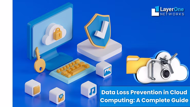
Data loss can be expensive and harmful to an organization’s reputation, regardless of size. Data loss prevention strategies are essential to reduce these risks. This guide discusses the importance of data loss prevention in cloud computing, examines various types of DLP solutions, and provides insights into how to prevent data loss in the cloud.
A Precise Idea About Data Loss Prevention In Cloud Computing
Data loss prevention, DLP refers to the process of solid strategies, practices, policies, and technologies designed to monitor and protect sensitive data from theft, unauthorized access, or accidental loss.
While using cloud services, businesses can transfer volumes of critical data to third-party providers or cloud computing companies, making practical implementation of DLP solutions even more crucial. Whether the sensitive information is customer data, health-related data, financial records, or contact details, the need for solid data security has grown.
Why Is Data Loss Prevention Crucial For Cloud Environments?
The cloud has revolutionized businesses’ operations, providing cost-effective, scalable, and flexible storage solutions. However, cloud environments, including private, public, and hybrid cloud, also expose organizations to potential data breaches and loss. The growing use of cloud computing resulted in more data being stored remotely, increasing the risk of cyberattacks and unauthorized access.
Sensitive data, including credit card numbers, personal health information secured by the Health Insurance Portability and Accountability Act (HIPAA), and other classified information, are at high risk in multiple cloud environments. Firms could experience financial loss and legal penalties when critical data is compromised without proper DLP strategies.
This practice of storing data in the cloud increases therisks of data loss in cloud storage and platforms.
Protecting Data In The Cloud: Understanding Primary Challenges
While cloud computing offers numerous advantages, it presents unique data loss prevention and security challenges. Businesses should resolve some of these difficulties.
Lack Of Data Visibility
One of the primary challenges and risks of using cloud services is the absence of complete visibility and control over the data stored in the cloud. Various businesses may rely on third-party providers, including the renowned cloud computing company, to secure their data, which sometimes results in gaps in data security protocols.
Data Breaches
Data breaches in cloud environments can result from both external and internal threats. Whether they occur through cybercriminal activities, hacking attempts, or the negligence of internal employees, businesses need to be cautious. In addition, unauthorized access to critical data can lead to major financial loss, reputational damage, and legal consequences.
Critical Data Compliance
Multiple industries should comply with strict data protection regulations, such as HIPAA for healthcare or the General Data Protection Regulation (GDPR) in Europe. These regulations force strict guidelines on how businesses handle personal and sensitive data. Failure to comply results in expensive fines and legal penalties.
How To Prevent Data Loss In Cloud Computing?
Effective DLP strategies require a combination of policies, technologies, and best practices to be implemented effectively. Organizations can take various essential steps to protect data in the cloud.
Real-Time Implementing A DLP Solution
Cloud DLP solutions offer robust tools for identifying, detecting, monitoring, and protecting sensitive information in real-time. These tools help organizations monitor and classify data in cloud computing, preventing unauthorized access to critical data. High-end DLP solutions also allow firms to define specific policies around data usage and transfer, ensuring that information is handled securely.
Establish A Robust Disaster Recovery Plan
Afterward, even with strong DLP measures in place, there is always a risk of data being compromised due to surprising events. For this reason, a disaster recovery plan becomes essential for businesses to enable smooth operations after disruption.
A combination ofa DLP solution and a disaster recovery plan outlines the critical steps that should be taken in the event of a data loss incident. This ensures minimal disruption to critical business operations and rapid data restoration using backup and disaster recovery services effectively. In addition, regular testing and updating of disaster recovery plans are also critical to ensuring effectiveness.
Data Classification
Understanding the different types of data your organization handles becomes the foundation of any DLP strategy. Accurately classifying data helps you prioritize protection for sensitive information, including credit card numbers, trade secrets, and personal information. A wide range of data classification tools can automatically categorize information based on predefined parameters, making monitoring and securing critical data easier.
High-End Encryption And Access Controls
Encrypting sensitive data at rest and transmission ensures that even if unauthorized individuals gain access, they cannot read the sensitive data. Access controls restrict who can edit, view, and share specific data within the cloud. Businesses can reduce the possible chances of data breaches by implementing strong access controls and encryption methods. During the accident event of data loss in cloud platforms,backup and disaster recovery services play a crucial role in retrieving data.
Regular Monitoring
Businesses should implement continuous monitoring systems that track data usage, transfers, and suspicious activity within the cloud to monitor data effectively. Multiple data monitoring tools can detect unusual behavior patterns that may signal a severe data breach. With real-time alerts, businesses can respond to potential threats and take immediate action to avoid data breaches and loss.
Use Cloud Access Security Brokers (CASB)
Cloud Access Security Brokers (CASBs) will act as intermediaries between users and cloud computing service providers, ensuring the organization’s security policies are applied across cloud environments. CASBs offer visibility into cloud usage, use compliance, and provide additional protection for sensitive data. By maintaining data integrity, these intermediate systems help prevent unauthorized data access in the cloud storage.
Best Practices For Cloud Data Security
Organizations should follow the best practices to avoid data loss in cloud computing effectively.
Multi-Factor Authentication (MFA)
Securely use multi-factor authentication (MFA) to add an additional security layer when accessing cloud services. The robust MFA requires users to provide additional verification, such as a one-time code, alongside their regular credentials, making it more difficult for hackers or unauthorized individuals to access cloud data.
Routine Data Backups
You must ensure that your business performs regular backups of data stored in the cloud. In the event of a data loss or accidental disaster, a recent backup can reduce downtime and prevent critical data from being permanently lost through data backup and disaster recovery services.
Employee Training And Development
Employees of any organization are the first line of defense when preventing data breaches. This function becomes the primary reason for manipulating somebody to reveal their access credentials. For example, regular training on cybersecurity best practices and how to handle data in the cloud can minimize the chances of manual error leading to data loss.
Vendor Assessments
When selecting cloud service providers or a reliablecloud computing company, ensure they follow strict high-security standards and comply with relevant regulations. It is also a best practice to audit your vendor’s security measures regularly to ensure that your cloud storage is reliable and secure.
Get Effective Data Protection With Robust Data Loss Prevention Strategies
As businesses continue to adopt cloud computing for their storage and operational needs, the risk of data loss remains a primary concern. Collaborating with an experiencedIT consulting firm can help implement a robust data loss prevention strategy, including advanced tools, best practices, and regular monitoring to protect sensitive data in the cloud.
Whether deploying a robust DLP solution, using role-based access controls, or utilizing cloud access security brokers, businesses need to be proactive in securing their data.
In addition, a solid disaster recovery plan will ensure quick recovery with minimal disruption. By following strict guidelines, firms can maintain trust, avoid data breaches, and protect their most valuable information from unauthorized access.